Čačvina fortress
Location: Čačvina, TriljLength: 300 mDifficulty: EasyDifficulty rating: K1, T1, VR1
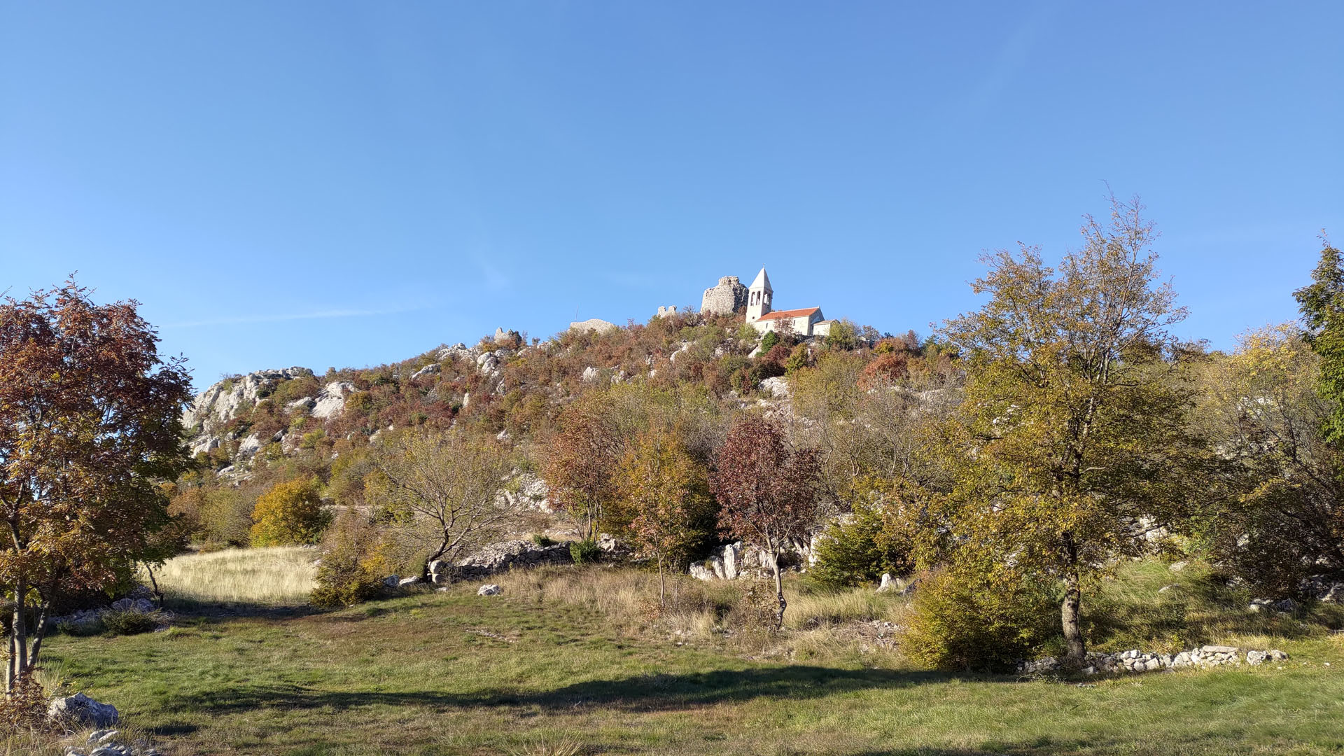
If you have ever traveled along the D220 state road, which leads from Trilj towards Buško Blato, you couldn’t have missed the fortress at the top of the hill. These are the kinds of locations you pass by when embarking on a longer journey, planning to reach your destination without accounting for climbing the hills you pass along the way.

When we started noting such places, it is incredible how large the list became over time. In the end, when you combine a few interesting spots located near each other, you get “material” for a full-day trip. We have many such “groups” of locations for numerous excursions throughout Croatia. Čačvina Fortress finally had its turn when we organized another trip in the wider Trilj area. Even though we had passed by it so many times, now, as we turned onto the local road and began approaching it, our hearts beat faster, and our impatience grew!
Čačvina Fortress is first mentioned at the beginning of the 14th century, during the reign of Prince Ivan Nelipić (Nelipčić). It was built on the site of a late antique fortress from the 6th century. Some parts of that older fortification were even incorporated into the new fortress.
The fortress was built in a strategically important position, on a hill about 8 kilometers northeast of Trilj. From this position, the main route from the Sinj field towards Bosnia was controlled. This is the previously mentioned D220 state road. Specifically, southeast of the Čačvina fortress, traces of an ancient 1st-century pavement have been preserved. The pavement was part of the main Salona – Argentaria route, an important Roman settlement in present-day Bosnia and Herzegovina, and it was used and maintained until the construction of modern roads.
The fortress served its purpose excellently for centuries. It changed many owners, and among others, it was managed for a time by the omnipresent Frankopans. During the Ottoman conquests, it was crucial for the defense of the Kingdom of Croatia. The Turks even offered 100,000 ducats to Duke Stjepan for it, but he refused their offer. Later, in the early 16th century, the Turks finally managed to conquer it, and after them, it passed into the hands of the Venetians. The French mined it during their rule.
The car can be parked on the meadow in front of the local cemetery. From there, a trail about 300 m long ascends.

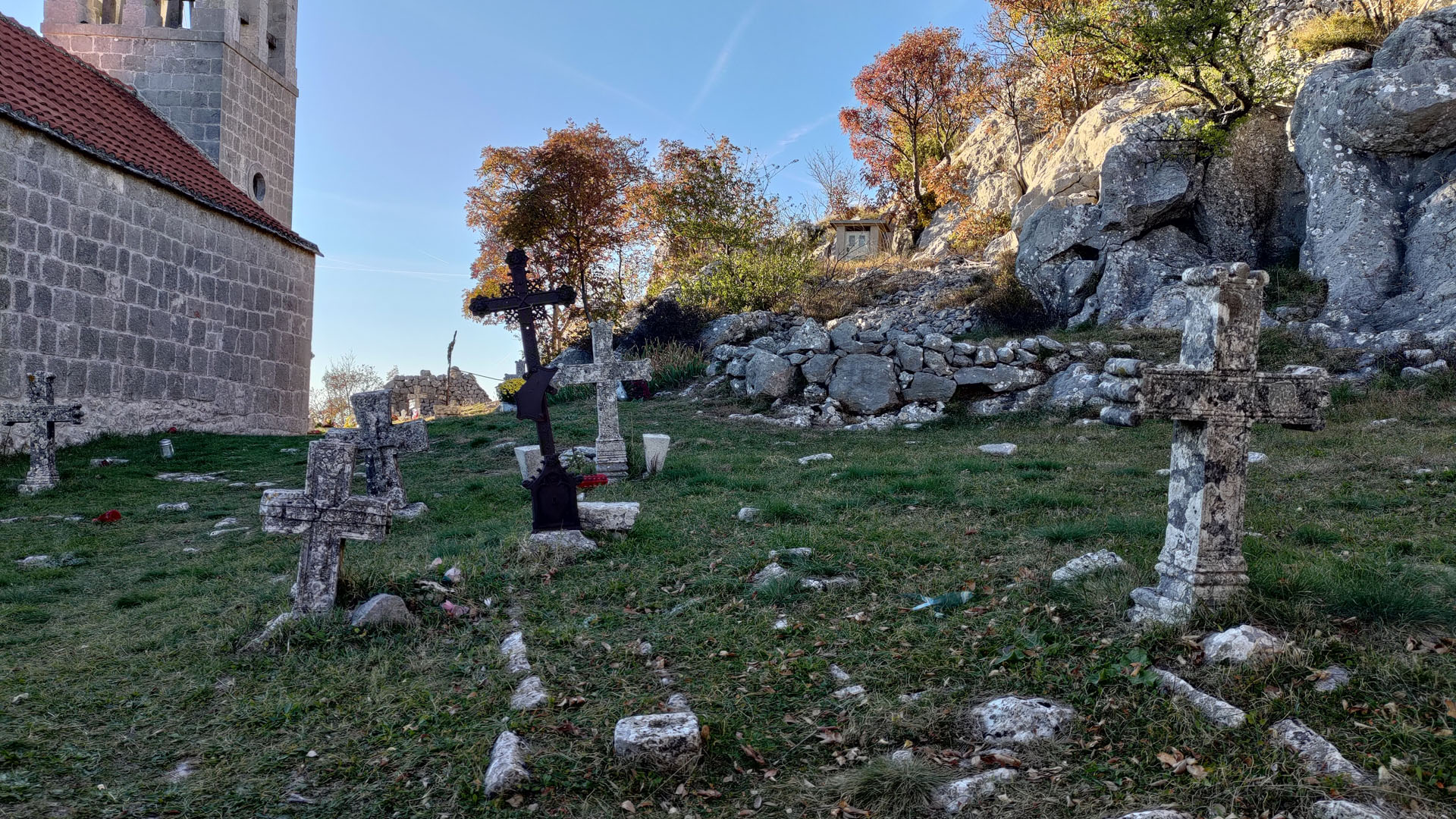
On the way to the fortress, we come across the Church of All Saints. The church dates back to the 18th century, and it is surrounded by an old cemetery. This place is special…
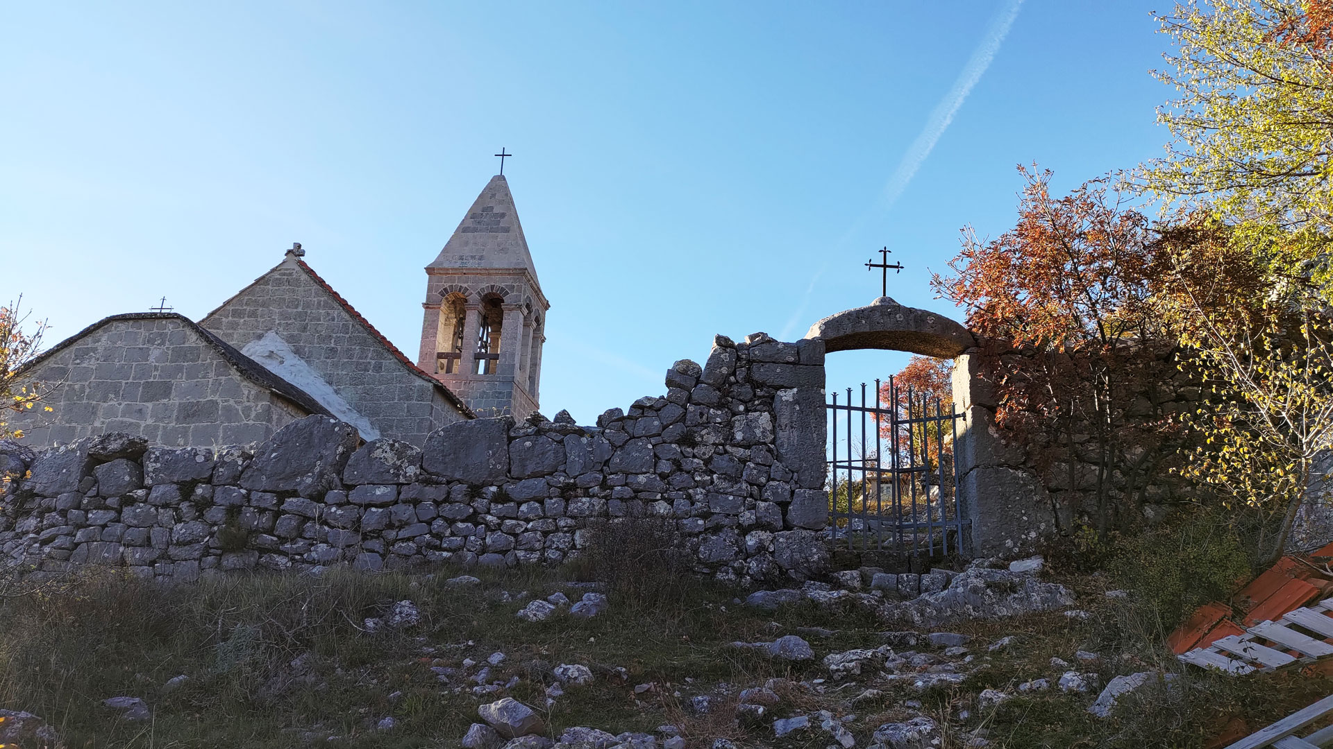
Although the church is monumental, the space around it is natural. There is no unnecessary concretization.
The beauty of the place where the Church of All Saints is located is enchanting!

Meadows, stones, dry stone walls, and old gates. Peace, silence, echoes of history, and beautiful views, tangled in an indescribable combination of emotions. Nostalgia, respect for ancestors, and admiration for the way locations were once chosen and arranged for the benefit of the community. Today, we could learn a lot from our ancestors, but we are often blind. We do not hear and we do not see.


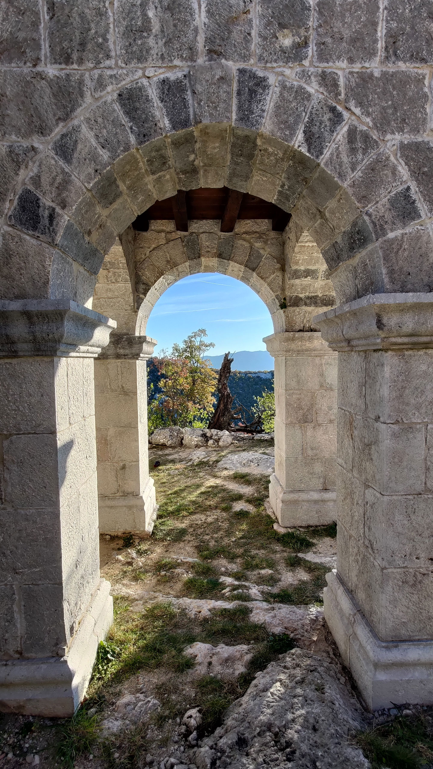
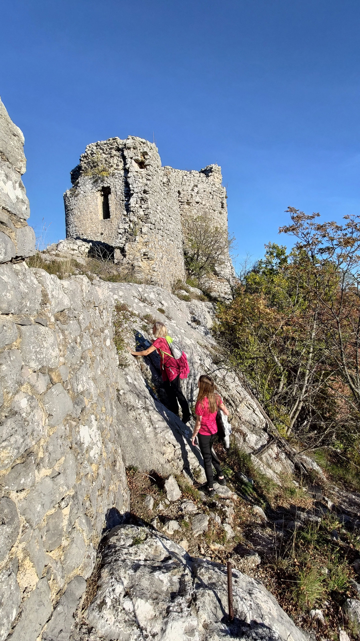
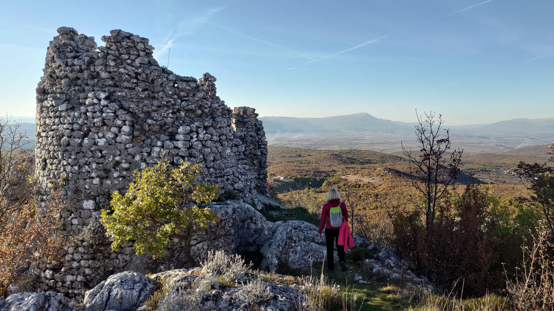
You can make the trail partially circular. If you pass through the churchyard, the path continues directly towards the fortress. True, at the end, you will have to “conquer” the walls, but it is not difficult.
For the return journey, you can choose the “main” path, which descends from the eastern side of the fortress to the road in front of the church.
Unfortunately, the intimacy of this place has been violated by “modern technology.” Next to the fortress, there are transmitters with accompanying equipment.


Special
Although our focus is on Croatia, due to great interest in reviewing some international locations from our travels, we decided to launch the Special section. In it, we will not cover locations in the same detailed way we do with Croatian ones, but will instead provide a brief overview of multiple locations grouped into meaningful categories. The only criterion we still strictly follow is that they must be natural attractions.